Vinohrady nad Váhom
| Vinohrady nad Váhom | |||||
 Drapeau | |||||
| Administration | |||||
|---|---|---|---|---|---|
| Pays | |||||
| Région | Trnava | ||||
| District | Galanta | ||||
| Statut | Village | ||||
| Starosta (maire) Mandat |
Eva Hanusová (Indépendant) mandat : 2018-2022 |
||||
| Code postal | 925 55 | ||||
| Plaque minéralogique |
GA | ||||
| Code LAU 2 | SK0212504157 | ||||
| Démographie | |||||
| Population | 1 678 hab. (31 déc. 2024[1]) | ||||
| Densité | 157 hab./km2 | ||||
| Géographie | |||||
| Coordonnées | 48° 18′ 28″ nord, 17° 45′ 50″ est | ||||
| Altitude | 166 m |
||||
| Superficie | 1 070,214 2 ha = 10,702 142 km2 | ||||
| Localisation | |||||
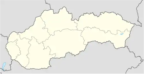
| Géolocalisation sur la carte : Slovaquie
Géolocalisation sur la carte : Slovaquie
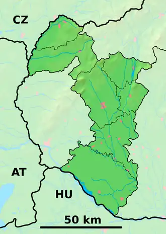
Géolocalisation sur la carte : région de Trnava
Géolocalisation sur la carte : région de Trnava
| |||||
| Liens | |||||
| Site web | https://www.vinohradynadvahom.eu | ||||
| Sources | |||||
| « Résultat des élections » | |||||
| « Statistique de population » | |||||
| http://www.e-obce.sk [2] | |||||
| http://www.statistics.sk [3] | |||||


Vinohrady nad Váhom est un village de Slovaquie situé dans la région de Trnava.
Histoire
Première mention écrite du village en 1958.
Notes et références
- ↑ (sk) « Počet obyvateľov podľa pohlavia - obce (ročne) [om7101rr_obce=AREAS_SK] », Statistical Office of the Slovak Republic, (consulté le )
- ↑ e-obce.sk
- ↑ Mestská a obecná štatistika SR
Voir aussi
 Portail de la Slovaquie